Course Number
Geog 625
SFSU Bulletin Description
Credits
4
Course Type
College
Department
Course Description
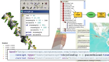
In this course, we learn a suite of methods that allow us to use programming logic to automate and build tools for desktop and web-based GIS and remote sensing. We’ll start by exploring Python, an object-oriented scripting language, to process desktop data for conversion of imagery, GIS, field survey and LiDAR data. Then we’ll shift to using Javascript to build functional GIS tools and interactive maps on the web, using APIs for Google Maps and ArgGIS.
Term