Course Number
Geog 629
SFSU Bulletin Description
Credits
3
Course Type
College
Department
Course Description
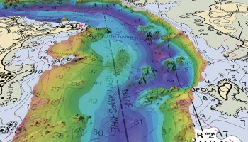
GIS for partial analysis to support coastal and marine research. Benthic habitat mapping, mapping and visualization for coastal/marine applications, spatial analysis of marine animal movements, habitat modeling and mapping of marine protected areas.
Term