Mapping Ecologically Functional Riparian Corridors Using LiDAR and Hydrologic Landscape Analysis
Abstract
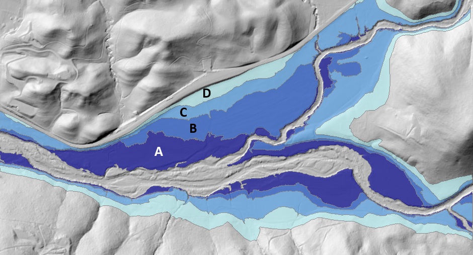
Riparian corridors and their associated geomorphic landforms (e.g., channels, floodplains, and terraces) and vegetation communities (e.g., forests and wetlands) have been significantly degraded in California, prompting an expansion of efforts to delineate riparian corridors and identify priorities for conservation via deed restrictions and easements. Commonly used techniques to delineate riparian corridors for these purposes include fixed-width buffers based on stream centerlines and digitization of woody vegetation from aerial photos. Although efficient, these delineation methods do not accurately capture the extent of ecologically functional riparian corridors and result in riparian habitat being excluded from conservation efforts while non-riparian is included. From a physical perspective, ecologically functional riparian corridors have widths that vary with topography and ample space for dynamic fluvial geomorphic processes that create and maintain river morphology and vegetation and sustain ecological interactions that extend from the stream channel laterally into upland ecosystems and up- and downstream ecosystems in longitudinal directions. New hydrologic landscape analysis techniques that use high-resolution digital terrain data show promise in delineating ecologically functional riparian corridors. We present a case study of an alluvial reach of Mark West Creek in Sonoma County, California, where a composite of four hydrological landscape analysis products—elevation above channel (EAC), flow accumulation, topography wetness index (TWI), and cost-weighted distance from the channel—is synthesized to approximate an ecologically functional riparian corridor. When compared with field-based indicators of the riparian corridor—soil type, fluvial geomorphic landforms, and vegetation—the synthesized composite demonstrates several advantages of using hydrologic landscape analysis over the common techniques.