Using Social Media to collect Spatial Political Information for Decision Support
Abstract
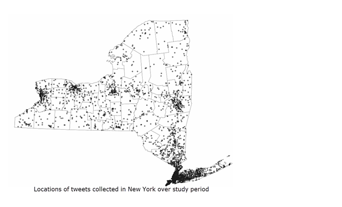
Fine-scale public opinion is important to politicians, special interest groups, and social organizers; it, however, remains cost-prohibitive. Twitter provides a wealth of information about public opinion. Most studies of public opinion using Twitter focus at the state level while important campaign decisions are made at finer scales than the state level. This study evaluates the usefulness of Twitter as a source of detecting fine-scale public opinion by expanding to the county level through collecting tweets based on a broader set of candidate-related hashtags as search terms, and the utilization of user location, a free-form text field, for resolving a greater number of tweets to a location on the Twitterscape.To explore the utility of county-level Twitter data, I present a case study of the New York State Democratic and Republican Presidential Primary Elections. This study reveals an urban bias in Twitter data, Spearman correlations as high as 0.78 between percentage of tweets about a candidate (Twitter share) and their vote share, a significant relationship between Twitter share the day before an election and vote share, and a higher rate of the use of coordinates and geotags for tweets favoring discussion about Democratic candidates. These results signal the usefulness of Twitter as a fine-scale sensor of public opinion and the potential as a driver for decision making in campaign strategy. Additionally, due to the wide-scale use of geographic weighted regression (GWR), a method is formalized for moving from an OLS model to a GWR using Moran’s I as a diagnostic on model residuals to investigate potential for non-stationarity in model relationships.This approach also emphasized the use of multiple hypothesis testing corrections such as the Benjamini-Yekutieli correction, as these corrections have been overlooked by many users GWR. Approaches for visualizing the outputs of such models are illustrated employing simple data visualization schemes that are easily repeatable on standard mapping software.