Department Information & Events

Events

News

  • Chloe Martin (MA Geography 2022) is off to a great start as the GISc Analyst in the Institute for Geographic Information Sci…
SFSU Aerial Photography Atlas

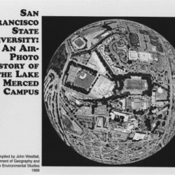
SFSU Historical Air Photo Atlas

Maps and aerial photographs of the SFSU campus site, dating back to 1899, with the first aerial photograph from 1935.  Created by former department professor John Westfall, who taught aerial photography for many years.
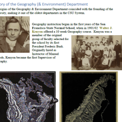
Alamo Square 1980

Max Kirkeberg Collection

A 50-year photographic documentation of the urban geography of San Francisco and the bay by Professor Emeritus Max Kirkeberg. His collection of just under 60,000 photos of streets, architecture, development, landscapes, culture, and geographical highlights dating back to the early 1970s.

Department History snapshot

Department History

Department history dating back to the early 20th century.